-
-
-
-
-

BIG SAVINGS
+EVERYTHING SHIPS FREE
Learn More


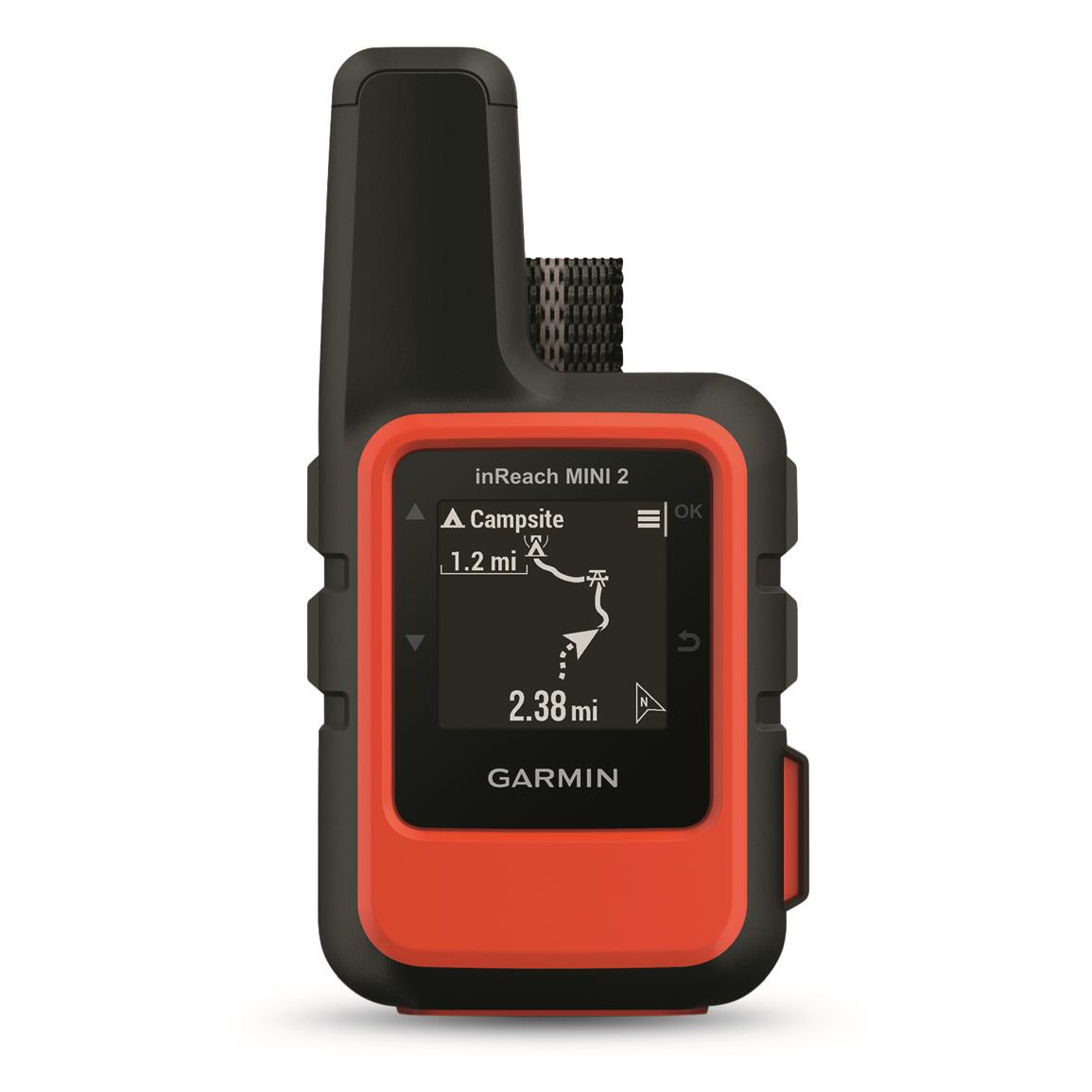
This is a carousel with one large image and a track of thumbnails below. Select any of the image buttons to change the main image above.
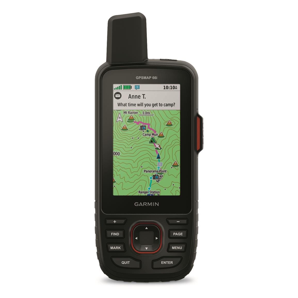
3" diagonal display with 240x400 pixel resolution
Key Features
- Rugged handheld with 3" color display
- Preloaded TOPO U.S. and Canada maps
- inReach® technology (satellite subscription required)
- Access to BirdsEye Satellite Imagery
- 16GB of memory; accepts 32GB microSD™ card
- IPX7 water rating
- Rechargeable lithium-ion battery with 35-hour life

Satisfaction Guarantee
Order with complete confidence! Your satisfaction is guaranteed, period! We stand behind every item we sell. If you're not happy within 90 days of shipment, just return the item with your invoice and we'll promptly refund your merchandise total. See More Details

Lowest Price Guarantee
For everything to outfit your passion...at the Lowest Prices, Guaranteed! If you find a lower advertised price for an item we sell, let us know at the time of purchase or within 10 days of placing your order and we will refund you the difference. See More Details


Precise navigation meets global communication in the rugged GPSMAP® 66i Handheld GPS and Satellite Communicator. The button-operated Garmin® GPSMAP® features TopoActive mapping and inReach® technology to give you a powerful tool for navigating safely in remote terrain. Familiarize yourself with the terrain before you arrive with preloaded TopoActive maps of the U.S. and Canada. You'll get maps as pretty as a picture, just as detailed—and without a subscription.
When cellphones can’t connect, inReach® can. Communicate with confidence using inReach® technology (satellite subscription required). With inReach®, you can trigger an interactive SOS to the GEOS 24/7 search and rescue monitoring center and communicate via two-way messaging using the global Iridium® satellite network. And compared to other Garmin GPSMAP 6 Series Handheld GPS units, you can stay out there longer with 66i. That's because it's equipped with a powerful rechargeable lithium-ion battery that gives you up to 35 hours of battery life in tracking mode and up to 200 hours in expedition mode. That's over double the battery life compared with other Garmin GPSMAP handhelds that use AA batteries.
inReach®-compatible. Communicate from anywhere.
Using the worldwide coverage of the Iridium satellite network, this go-anywhere portable device lets you exchange text messages with any cell phone number or email address from anywhere. Or use the GPS to track and share your journey’s progress. You can also post to social media, or even communicate inReach-to-inReach while in the field. In case of an emergency, you can trigger an SOS distress signal to a monitoring center, text back and forth about the nature of your emergency, and receive confirmation when help is on the way. And no worry if you're not within range of a cell tower. inReach® technology works anywhere and everywhere—so you’re never out of range. You’ll need an active satellite subscription to access the Iridium satellite network for tracking, messaging and interactive SOS. Check out the subscription options at https://www.garmin.com/en-US/inreach/personal/#subscriptions
Smart Solutions On and Off the Trail
Turn on the tracking function and let family and friends follow your progress from a computer or mobile devices. inReach sends waypoints at preselected time intervals, so followers can track your whereabouts using the web-based MapShareTM portal. Plus, get GPS on-map guidance with preloaded TOPO mapping and waypoint routings viewable directly on the unit. The device also has a built-in 3-axis electronic compass, barometer to monitor weather, and altimeter to view elevation data. For even more capability, use the free Earthmate® app to sync it via Bluetooth® with a compatible Apple® or AndroidTM device to access unlimited maps, aerial imagery and U.S. NOAA charts.
- Rugged handheld with 3" sunlight-readable color display for easy viewing
- Multiple Global Navigation Satellite Systems (GPS and Galileo) gives you more powerful navigation information in more challenging environments than GPS alone
- 3-axis compass, altimeter for elevation data, and barometer to monitor weather
- Know the terrain before you’re in it with preloaded TopoActive maps of the U.S. and Canada
- Access to BirdsEye Satellite Imagery with no annual subscription, plus direct-to-device downloads
- inReach® compatible (satellite subscription required)
- inReach® lets you trigger an SOS to the 24/7 search and rescue monitoring center and gives you two-way messaging via the 100% global Iridium® satellite network
- Rechargeable lithium-ion battery with up to 35-hour life at 10-min. tracking; up to 200 hours at 30-min. tracking (power save mode)
- Expanded wireless connectivity supports Wi-Fi®, BLUETOOTH®, and ANT+®
- Compatible with Garmin ExploreTM app to map, track, sync and share your trek from anywhere
- What's in the box:
- GPSMAP 66i
- Access to Birdseye Satellite Imagery
- USB cable
- Carabiner clip
- Documentation
Order today!
Key Specifications
- Item Number: 718482
- Display Size: 1.5"w. x 2.5"h.; 3" diagonal
- Display Resolution: 240x400 pixels
- Display Type: Transflective color TFT
- Basemap: Yes
- Waypoints: 10,000
- Routes: 250, 250 points per route; 50 points auto routing
- Track Log: 20,000 points, 250 saved gpx tracks, 300 saved fit activities
- Water Rating: IPX7
- Battery: Internal rechargeable lithium-ion
- Battery Life: Up to 35 hours at 10-minute tracking; Up to 200 hours at 30-minute tracking (power save mode)
- High-sensitivity Receiver: Yes
- Interface: High-speed micro-USB and NMEA 0183 compatible
- Barometric Altimeter: Yes
- Compass: Yes (tilt-compensated 3-axis)
- Geocaching-friendly: Yes (Geocache Live)
- Custom Maps Compatible: Yes (500 custom map tiles)
- Hunt/fish Calendar: Yes
- Sun and Moon Info: Yes
- Picture Viewer: Yes
- BirdsEye Direct to Device: Yes
- MicroSDTM Card: Yes (32GB max microSDTM; not included)
- Memory/History: 16GB (user space varies based on included mapping)
- Dimensions: 2.5" x 6.4" x 1.4"
- Weight: 8.1 oz. with batteries
- Mfg. Number: 010-02088-01
Related Products
Use Previous and Next buttons to see other related products.


Garmin GPSMAP 66i Handheld GPS and Satellite Communicator
$599.99 /